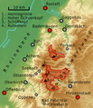
File:Nationalpark-Schwarzwald-Lageplan.png

Size of this preview: 517 × 599 pixels. Other resolutions: 207 × 240 pixels | 414 × 480 pixels | 724 × 839 pixels.
Laga ekifaananyi ekijjuvu (pikseli 724 ku 839 , bunene bwa fayiro: KB 820, kika kya MIME: image/png)
Ebyafaayo ebya fayiro eno
Bw'onyiga ku nnaku n'essaawa, ojjakulaba fayiro nga bwe yali efaanana ku kiseera ekyo.
| Ennaku n'obudde | Kulingiza | Obuwanvu n'obugazi bwakyo | Eyakiteekawo | Okulw'ogerako | |
|---|---|---|---|---|---|
| oluwandika oluliwo kakano | 01:34, 8 Gwamusanvu 2014 |  | 724 × 839 (KB 820) | Sitacuisses | clarity |
| 09:03, 8 Gwamukaaga 2014 |  | 724 × 839 (KB 786) | Sitacuisses | + Rhein, Murg; ... | |
| 00:06, 6 Gwamukaaga 2014 |  | 724 × 839 (KB 775) | Sitacuisses | various modifications | |
| 06:23, 4 Gwamukaaga 2014 |  | 735 × 809 (KB 658) | Sitacuisses | scale and more | |
| 05:03, 4 Gwamukaaga 2014 |  | 735 × 809 (KB 650) | Sitacuisses | {{Information |Description ={{en|1=The north western Black Forest with the Black Forest National Park (Nationalpark Schwarzwald). Map based on NASA SRTM-3 data.}} {{de|1=Lage des Nationalparks Schwarzwald im nordwest... |
Empapula eziriko enyunzi ezigguka ku kifaananyi kino
Empapula 2 ezikuggusa ku fayiro eno ze:
Global file usage
The following other wikis use this file:
- Usage on arz.wikipedia.org
- Usage on ast.wikipedia.org
- Usage on bh.wikipedia.org
- Usage on bn.wikipedia.org
- Usage on cbk-zam.wikipedia.org
- Usage on ckb.wikipedia.org
- Usage on da.wikipedia.org
- Usage on de.wikipedia.org
- Usage on dty.wikipedia.org
- Usage on en.wikipedia.org
- Usage on fo.wikipedia.org
- Usage on gu.wikipedia.org
- Usage on hi.wikipedia.org
- Usage on it.wikipedia.org
- Usage on kn.wikipedia.org
- Usage on mai.wikipedia.org
- Usage on ml.wikipedia.org
- Usage on my.wikipedia.org
- Usage on ne.wikipedia.org
- Usage on nl.wikipedia.org
- Usage on pa.wikipedia.org
- Usage on pl.wikipedia.org
- Usage on simple.wikipedia.org
- Usage on si.wikipedia.org
- Usage on sr.wikipedia.org
- Usage on te.wikipedia.org
- Usage on tum.wikipedia.org
View more global usage of this file.